
Ontario is …vast.
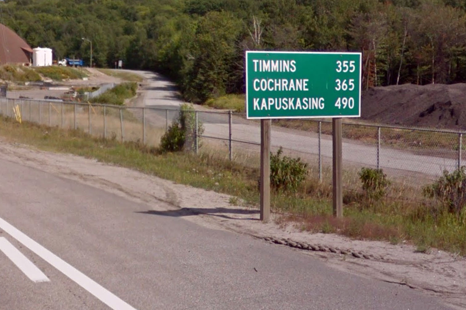
Imagine getting in a car in Toronto and travelling due north for about 4 hours. Now head east for another 4 hours. Then start heading generally northeast for 11 more hours. You’ll still be in Ontario, around Thunder Bay if road conditions are favourable. It will take another 6 hours to reach the Manitoba border, and you’ll be in another time zone when you do. By then Toronto will be 1960 km away.
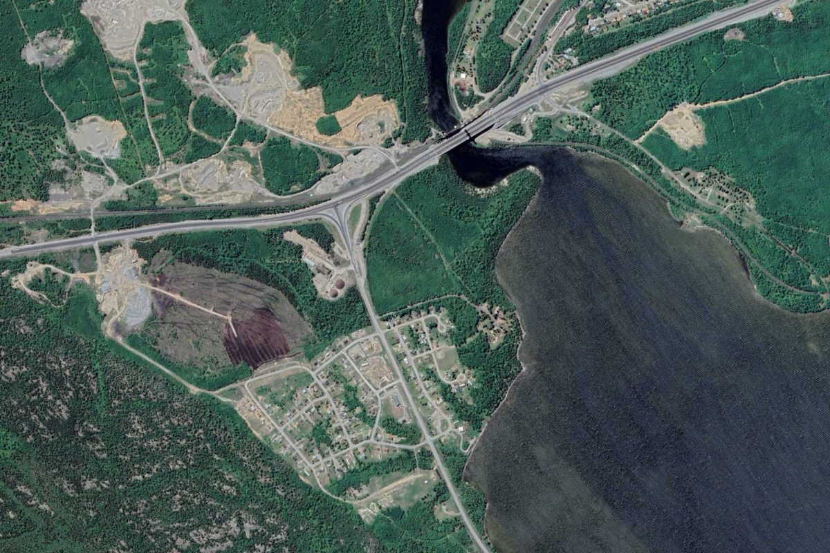
I’ve been using Google Earth to travel around Ontario while remaining adherent to physical distancing guidelines. Way back in 2000 I spent about two school years in North Bay, the southern most part of what’s considered the northern part of the province. I remember from driving back and forth how Highway 11 from Toronto and Highway 17 from Ottawa would meet just south of North Bay. The two highways split a few kilometres later with Highway 11 heading north to Temiskaming and Highway 17 heading west to Sudbury.
While most of Southern Ontario is accessible via road, most of Northern Ontario isn’t. Distance is experienced on another scale. What might be considered remote takes on a new meaning. Isolation becomes relative. Whenever I’d reach the junction of Highway 11 and 17 coming up from Toronto I knew I was almost at my destination, a reassuring feeling when the remaining destinations were in distances measured with three digits.
Recent events have knocked any sense I’ve had of distance and isolation into flux. Two meters may as well be 2000 kilometres. Ideas of what’s considered accessible no longer revolve around a specific type of vehicle. In a screwed up way it’s now possible to see more of the province from space on my couch than I ever could from a car or even a canoe. And in that realization—as I was scrolling through the air above Highway 11 past North Bay; as the road wound its way through places I’ve never heard of; as it found and blasted its way though unending forest and rock or hugged the shores of lakes and rivers; as it branched off into route numbers starting in the five and six hundreds; as Highway 11 headed down and met up for the second time with Highway 17—I found myself looking at loneliness.
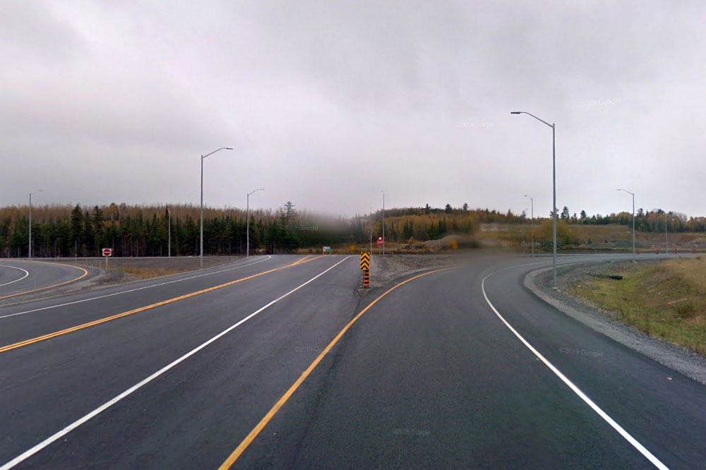
Above is the view looking south from Highway 11 at Highway 17, near Nipigon, where the two longest highways in Ontario meet again to form the only road access the two halves of the country have with the other. To the right it’s 786 km west to Winnipeg. To the left it’s 586 km southeast to Sault Ste. Marie and then 795 km from there to Ottawa. Or it’s back 1345 km northsoutheast to Toronto.
And that’s not the loneliness. No—not there yet.
Ontario has an area of 1,076,395 km2 making it larger than Germany, France, and Italy …combined. But that view—the clouds, the sense of the weather, the trees, the fields, even the road signs, pavement markings, and intersection—I bet that view can be found by anyone in Ontario. It’s somewhere anywhere in the province. It’s a few hundred square metres among millions more just like it.
And that’s still not the loneliness. Almost there…
That view of a place that looks like it’s anywhere is actually a view of a place that’s mostly nowhere. It’s a synthetic view, accessible to anyone here only if they’ve also got access to a road. Most places in Ontario cannot be arrived at by road, but most everyone who lives here is near one, so almost everyone living here thinks Ontario looks a way it actually doesn’t. I count myself among almost 15 million people who likely haven’t seen much of this province past the view from a road.
That’s the loneliness.